

In the southern United States, from Texas to Florida, construction is booming. Data centers are going up in Houston, manufacturing campuses are spreading across the Carolinas, and road infrastructure work is stretching from the Gulf Coast to Florida ports. But growth comes with its own kind of pressure. Larger, more complex projects mean more layered operations, tighter margins, and less room for surprises. The buried utility that no one flagged, the qualification bug caught two weeks too late, or the client meeting where the only proof of progress is a project manager’s best guess are becoming bigger problems as sites grow and projects multiply.
In recent decades, the construction industry has adopted new and more sophisticated tools for designing and managing projects, while the way most teams view their site has barely changed. A survey team may visit once a quarter. A superintendent walks the site each morning with a clipboard or telephone. Somewhere between these snapshots, changes can occur without anyone noticing, until it shows up as a change order, a missed milestone, or even an on-site accident.
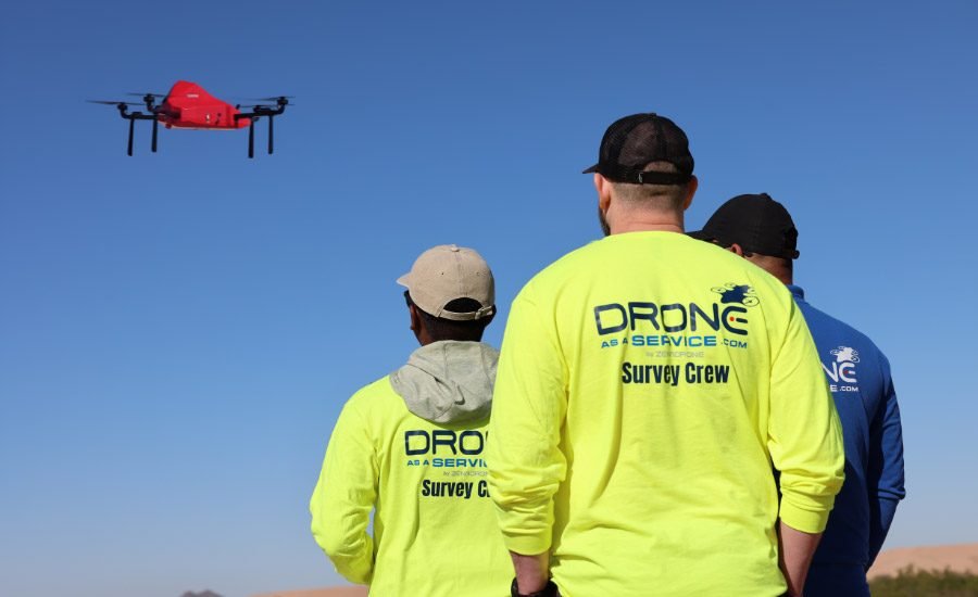
Drones have become a game changer, providing visibility where construction professionals need it most. While some operators choose to build an in-house drone program, doing so requires a significant investment, leading many to consider more flexible and accessible solutions. With Drone as a Service, instead of buying hardware, training pilots, and navigating FAA compliance, contractors, engineers, and building owners can simply subscribe to recurring aerial data collection, weekly, biweekly, or tied to project milestones. Drone as a Service delivers processed, decision-ready, centimeter-level data to support projects at every step, with no downtime or additional costs.
Faster, richer and more frequent data
Drones dramatically change what can be measured and how often, making surveying and inspection more precise and flexible than traditional methods. This flexibility is achieved through tailor-made solutions, combining specific drone platforms with various types of sensors and cameras, depending on what a project requires.
Drone as a Service platforms can carry high-resolution RGB cameras for photogrammetry and construction progress records, LiDAR for terrain elevation data, thermal and infrared cameras to detect moisture intrusion, insulation gaps or equipment hot spots, and multispectral sensors for vegetation and drainage analysis on larger land development sites. These sensors offer better accuracy than licensed ground surveying, while drone platforms allow for more regular and faster inspections.
The speed difference is as important as the sensor capability. A traditional ground survey of a 20- to 40-acre construction site can take a team from several days to two weeks of fieldwork, plus additional office time to process the data. A drone can survey the same site in a matter of hours and turn around a usable model in 48 hours. Because flights are fast and repeatable, teams can fly weekly or biweekly instead of once a quarter, turning survey data from an occasional snapshot into a running record. This recurring, high-frequency data is what allows a project manager to spot errors immediately, rather than discovering them after a week of work.
Fewer errors, fewer delays, safer customer reports
This combination of speed and accurate data is ultimately what keeps costs down. Errors such as a drainage conflict, misaligned grade, or design-to-design discrepancy can be inexpensive to fix when caught early. But they can also lead to rework, change orders, and seriously stalled schedules when caught too late, eroding margins quickly. It also affects indirect costs, such as delays while an investigation occurs or dominant schedule effects. Drone as a Service enables construction professionals to avoid delays and unexpected costs at every stage of a project’s life cycle, thanks to a fleet of autonomous drones equipped with next-generation implements.
In the early stages of a project, drones equipped with LiDAR sensors and high-resolution cameras help construction professionals gain a detailed understanding of existing site conditions. These implements capture accurate 3D point clouds, which are used to generate terrain models that support critical tasks such as cut and fill calculations, site planning, and design. Combined with high-resolution orthomosaic maps, which are generated using photogrammetry, these products help precisely define site boundaries and support more informed planning from the outset.

Regular drone flights provide a visual record of construction progress, monitor daily operations and improve site safety.
Image by David Pickup | pexels
During the construction phase, drone-generated elevation and terrain models help monitor site level, drainage, and earthmoving volumes over time. Regular drone flights equipped with high-resolution cameras provide an up-to-date record of construction progress, monitor operations and ensure site safety. Thermal imaging scanners can also detect heat-related problems in buildings, equipment and electrical systems before they create irreversible damage or endanger on-site equipment. With Drone as a Service, this critical data can be captured in hours, processed and delivered in days, and integrated directly into the engineering, GIS, and project management platforms teams already use.
Because drones produce objective, time-stamped, georeferenced data rather than a subjective verbal update, they strengthen a project team’s communication to clients, lenders, or executives. For example, multispectral terrain maps can support environmental compliance reports, while 4K cameras can accurately track construction progress ahead of key client presentations. This quality of reporting protects a project internally and strengthens the relationship of trust with clients.
Video courtesy of Drone as a Service
Get the right data while keeping your teams safe
Another key benefit of Drone as a Service is the number of people on a job site who no longer have to put themselves in harm’s way to do a job. Traditional surveying often means walking near open excavations, moving equipment, unstable slopes, or partially built structures. Manual inspections increase this risk by sending workers to scaffolding, on roofs, in confined spaces or near active equipment.
Drone as a Service can perform autonomous flights of the same area or targeted inspections, capturing key viewpoints and collecting survey-grade measurements without anyone entering a hazardous area. Over the life of a project, this means less exposure to the risk of falls, heavy equipment traffic and unstable terrain, while giving project and safety managers the documentation they need. Fewer physical inspections in hazardous areas also mean fewer opportunities for incidents that lead to direct costs, such as medical claims, insurance and downtime.
Drones create a shared data layer for builders, engineers and customers
By combining the skills of licensed pilots, the capabilities of FAA-registered drones, and end-to-end data management services, Drone as a Service replaces scattered subjective updates with a single, continuous, objective data layer. Project managers get advocacy reports, engineers get clean, CAD-ready data, and field leaders get complete site visibility without added risk. But none of them manage a new system; now they just work from the same playbook.
Construction in Texas and the Southeast isn’t slowing down, and neither is the pressure to deliver more projects, faster and with fewer surprises. To support these projects and the teams behind them, it’s critical to close the visibility gap between what’s designed, what’s reported, and what’s actually happening on site. With its flexible, subscription or on-demand models, Drone as a Service takes the guesswork out of it, one drone flight at a time.
To learn how drones can help improve your business, visit https://www.droneasaservice.com/construction-progress-update/.
